Groundradar is the world leader in ground penetrating radar applications to nickel laterite exploration and resource definition. Staffs have conducted large-scale radar projects on over 60 deposits on six continents, in environments ranging from the Amazon jungle to the mountains of Madagascar.
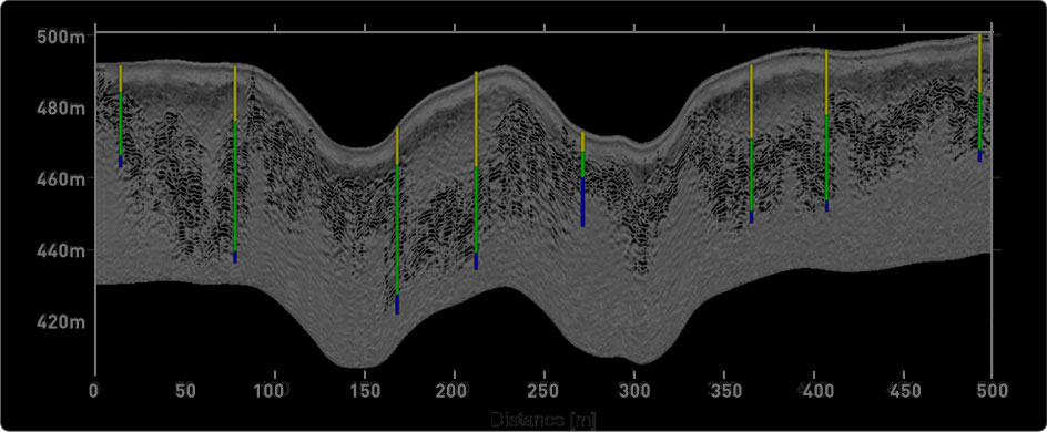
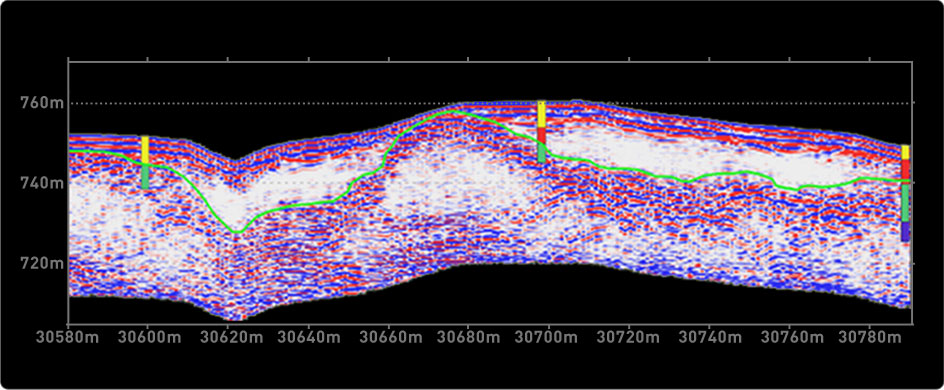
Radar technology has the ability to continuously image the details of the weathering profile. An intrinsic characteristic of lateritic environments is their extreme lateral variability in depth. These abrupt changes in horizon elevations are commonly undetectable by drilling at any economic grid spacing. Overcoming this limitation of drill-based laterite exploration requires an inferential statistical approach to mineral resource estimation. By using radar technology to accurately map the volume of the deposit, coupled with a fewer number of strategically-positioned boreholes to confirm the layer identification and grade, a geoscientifically sound and measured resource estimate can be made quickly and economically
UltraGPR has been designed specifically for deep imaging requirements, employing the leading edge in radar technology. Compared to commercial GPR instruments, UltraGPR offers increased penetration, accuracy, ease of use, speed of surveying and reliability. Real-time sampling technology has enabled the imaging of deeper reflections than has been possible with commercially-available systems to date. Depths of up to 75 m have been achieved in lateritic weathering profiles with UltraGPR, whilst maintaining excellent profile resolution. By eliminating all wires and fiber optic cables, as well as cumbersome control units and batteries, the UltraGPR has been reduced to a single 9 m long tube. The traditional laptop computer used on commercial GPR systems has been superseded by the use of a mobile phone or PocketPC to control acquisition parameters and store data. Communication between components employs Bluetooth technology. The unit is completely waterproof and can be deployed over the most challenging of terrains.


