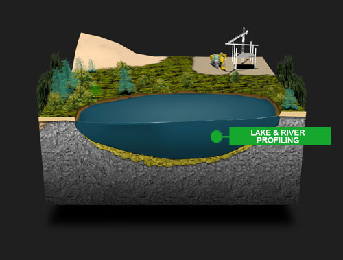
Groundradar has pioneered the use of GPR systems for lake and river sub-bottom profiling since 1992. With the advent of UltraGPR, enabling the entire radar system to be submerged or floated, rapid aerial mapping at low cost is possible. Groundradar often complements UltraGPR surveying with acoustic sub-bottom profilometers and fathometers. As is the case on land, fined-grained sub-bottom sediment can be highly attenuative to radar energy, whereas such clays and silts are ideal for acoustic profiling. Conversely, coarse-grained gravels and sands are ideal radar environments, but are unsuitable for acoustic methods. A combination of the two technologies can provide a complete model of the subsurface. Radar is only suitable in freshwater environments.