SRK Exploration Services of Cardiff, Wales, has used UltraGPR technology to map an iron sands deposits along the north-west coast of Greenland. The site is extremely remote and is only accessible during the summer. This site marks the northernmost (and likely most remote) location UltraGPR has been used.
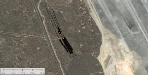
A series of trials in using long-range GPR technology have been undertaken near Newcastle, NSW, to map LOX lines bisecting coal strata.
A paper entitled “Realistic GPR Performance” presented by Dr. Francke won the best paper at the South African Geophysical Association Conference in Cape Town.

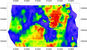
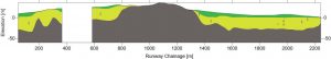
Groundradar continues to develop custom radar instruments and processes for Rio Tinto’s Weipa operations in Queensland, intended to accurately and consistently map the thickness of bauxite atop an ironstone underburden.
Monostatic 100 MHz flexible radar
Groundradar has visited the GEMCO mine in Groote Eylandt to test long-range radar’s ability to map manganese deposits beneath clayey sand.
Experiments with fat dipole antennas (no advantage over normal dipoles)
Following from successful tests in 2016, a larger field program at Argyle Diamonds was started by Groundradar and continued by Argyle staff to map paleochannels adjacent to the primary mining operations.
Dr. Francke will present a paper entitled “Realistic GPR Performance” at the South African Geophysical Association’s Conference in Cape Town in September. The paper addresses claims made of extraordinary and unrealistic radar performance by some vendors in Southern Africa and Australia using Russian/Ukrainian “megawatt” radars. The paper clearly shows that these performance claims are entirely outside of the bounds of accepted physics and such instruments can pose a significant safety risk.

AMR Gold is using UltraGPR technology to map coltan bodies in a remote part of Sierra Leone. To date, the UltraGPR has been able to consistently map these bodies to depths of over 70 m. Regardless of the rugged conditions, over 40 km of survey distance has been collected over a grid, showing the dip and strike of the coltan targets in 3D.
Depth of eluvial cover
A trial UltraGPR survey in Rwanda was undertaken in an effort to map tin-bearing paleochannels. In this case, due to the high clay fraction in the sediments, penetration was limited to a few metres, even with very low-frequency antennas (10 MHz).
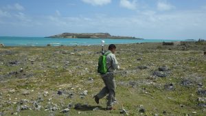
 ver rough karstic limestone which would have rapidly shredded any radar with fiber optic cables.